
MOUNT RANTEMARIO - 3,478 M
Mount Rantemario (3,478m) is the highest point on Sulawesi Island. It’s a part of the mountain range called Latimojong. It lies on the northern part of South Sulawesi. The Latimojong range has many peaks besides Rantemario, and it’s all above 3,000 m.
OVERVIEW
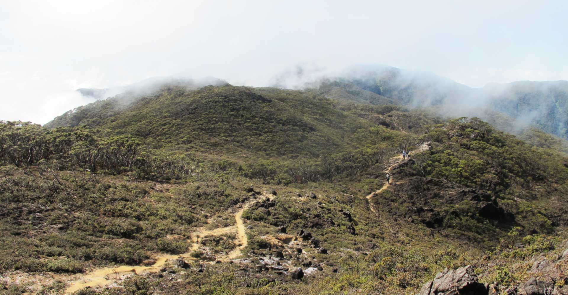
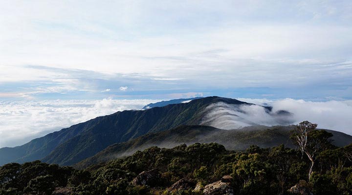
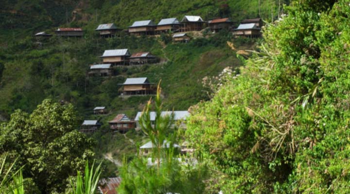
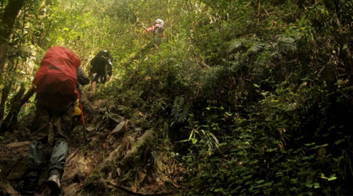
Mount Rantemario (3,478m) is the highest point on Sulawesi Island. It’s a part of the mountain range called Latimojong. It lies on the northern part of South Sulawesi. The Latimojong range has many peaks besides Rantemario, and it’s all above 3,000 m. Most of it had been climbed before. Though, the vast area of the mountain range is not fully explored and other peaks besides Rantemario was less climbed. Most of all, Latimojong Range is a sanctuary for the endangered species, Mountain Anoa. We sometimes still can see the trace of them when trekking on the mountain. But it’s very hard to see one. Sadly, the range hasn’t been established as National Park, not even a National Reserve. The most popular route to climb Rantemario is from the west ridge. From Makassar, we have to drive for 8 hours to the village of Baraka. And then continue using 4WD vehicle to the village of Karangan. The way to Karangan itself is an adventure. The muddy track is very rough, and it was made on the edge of the cliff. But the view is very stunning. The valley is very deep and wide making it magnificent. It takes 4 hours until the village behind the mist, Karangan, lies right on the foot of the mountain. From there, we start to walk through the coffee plantation until entering the jungle to the beginning of the ridge. Once we are on the ridge, it’s a steep hike all the way to summit ridge. It’s usually takes 2 days to the summit ridge from Karangan, but it’s also can be done in a day. From summit ridge to the summit is not too far, the meadow is very beautiful, and a lot to explore.
ITINERARY
- DAY 1
- Makassar-Baraka-Karangan Meeting point at Makassar in the morning. Our guide will pick you up at the airport or any other place agreed upon. We will have a long ride today by vehicle from Makassar to Karangan village, the starting point for trekking. First, we go by vehicle for 6-7 hours to Baraka. Then we change to 4WD vehicle, or truck, or motorcycle to Karangan village. We will stay overnight in the villager’s house.
- DAY 2
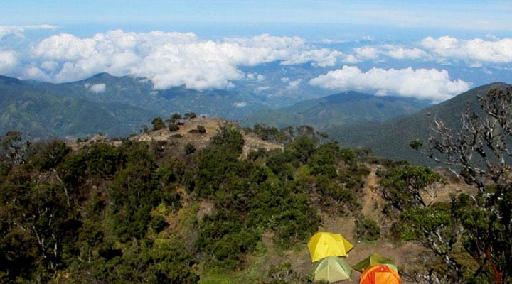
- Karangan-Camp 5 We start trekking in the morning. It takes 5-6 hours today to camp 5. We will walk through coffee plantation and following the river upstream until we cross the river and arrive at camp 2. There’s a rock shelter often used as camp. From there, the trek getting steeper until the flat ground called camp 5. We camp here for tonight.
- DAY 3
- Camp 5-Summit-Camp 5 We start early in the morning to the summit. Another steep up hike to an open area where trees becomes shrubs, and this area usually make as a camp also called camp 7. From there, another short hike to summit ridge before we traverse to the summit. Mount Rantemario in Latimojong mountain range have many unique plants and also a sanctuary for the endangered Mountain Anoa. You can see the long mountain range of Latimojong from the top with many other interesting peaks. After summit, we go back to camp 5 and stay overnight.
- DAY 4
- Camp 5-Karangan-Baraka Today we descend back to Karangan. Take a couple hours rest at Karangan for lunch and then back to Baraka. Stay overnight at villager’s house in Baraka.
- DAY 5
- Baraka-Makassar Go back to Makassar by vehicle in the morning. End of trip or you can take additional trip to Toraja.
INCLUDE
- Transportation Makassar-Baraka round trip by private vehicle
- 4WD Transportation Baraka-Karangan round trip
- Meals for the whole program
- One night’ accommodation (homestay) at Karangan
- One night’ accommodation (homestay) at Baraka
- Trekking permits
- Indonesia Expeditions guide
- Cook & Porters
- Sleeping tents, Dining tent, Tables & Chairs
- Inflatable mattress
- Fuel, Stove, and Cutlery
- First aid kit
EXCLUDE
- Transportation to Makassar round trip
- Meals & Accommodation in Makassar
- Additional trip to Toraja
- Personal natural expense (laundry, telephone, etc)
- Personal equipment
- Personal insurance
- Gratuities
PREPARATION
Though trekking on Mount Rantemario is short, but the trek is steep all the way. You need to be fit enough to get to the summit. Focus your train on cardiovascular capability. You can do running two to three times a week for 45 minutes to an hour per session. Running on a route that have elevation gain will be a lot better, or use treadmill if there’s no such terrain in your hometown. You can change one of your running sessions in a week with cycling or swimming and especially you need to do also stair climbing with at least 10kg pack. It will be a good cross training. Besides that, muscle training is advisable. Strengthen your upper and lower body muscle, as well core muscle. You can do it at the gym or do your own set of push-ups, sit-ups, pull-ups, plank, etc. You need to train 3 months prior to the expedition. It will increase the rate of success.
GEAR LIST
| No | Name | Amt |
|---|---|---|
| 1 | Trekking boots | 1 pair |
| 2 | Trekking Pole | 1 pair |
| 3 | Wool or Synthetic socks | 2 pair |
| 4 | Liner socks | 2 pair |
| 5 | Trekking shirts (polyester/quick dry) | 3 |
| 6 | Trekking pants | 2 |
| 7 | Soft Shell Jacket/puffy | 1 |
| 8 | Rain Jacket & pants | 1 |
| 9 | Baseball cap | 1 |
| 10 | Beanie | 1 |
| 11 | Buff (amount based on preferences) | 2 |
| 12/td> | Sunglasses | 1 |
| 13 | Lightweight synthetic gloves | 1 pair |
| 14 | 30L Backpack | 1 |
| 15 | Sleeping bag 5-10°C | 1 |
| 16 | Headlamp with spare batteries | 1 |
| 17 | Sunscreen, SPF 40 or better | 1 |
| 18 | Lip screen, SPF 30 | 1 |
| 19 | 1 Litre water bottle or water bladder | 1 |
| 20 | 1 Litre thermos | 1 |
| 21 | Toiletry bag | 1 |
| 22 | Large Duffel Bag | 1 |
| 23 | First aid kit and special medications (if any) | 1 |
| 24 | Camera | 1 |